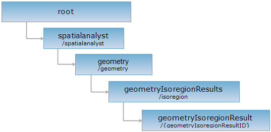
<geometryIsoregionResults_uri>/{geometryIsoregionResultID}[.<format>]
Gets isoline extraction result..
Supported methods
Supported output formats:rjson, json, html, xml.

Below is an example of performing an HTTP request on a specified URI with rjson as the output format. supermapiserver in the URI is the name of the server.
http://supermapiserver:8090/iserver/services/spatialanalyst-sample/restjsr/spatialanalyst/geometry/isoregion/1.rjson
Gets the isoregion extraction result
Normal response code(s): 200.
After implementing the GET request, the response structure is as follows:
| Name | Type | Description |
| succeed | boolean | Whether the spatial analysis is successful. |
|
message |
string | The message returned when the spatial analysis fails. |
| dataset | string | The result dataset identity. |
| recordset | recordset | The result recordset, used to store spatial object information. When implementing the POST request on the geometryIsoregionResults resource, the spatial object information will be displayed only if dataReturnMode of dataReturnOption is set to Recordset. |
Implement the POST request and you will get the result as follows:
{
"dataset": "geoIsoregion@Interpolation",
"message": null,
"recordset": null,
"succeed": true
}
Asks for the response identical to the one that would correspond to a GET request, but without the response body. This is useful for retrieving meta-information written in response headers, without having to transport the entire content. The meta-information includes the media-type, content-encoding, transfer-encoding, content-length, etc.
The HEAD request helps check the existence of the geometryIsoregionResult resource and whether it can be accessed by the client. By implementing the HEAD request on the URI, with .<format> appended to the end, we can quickly get to know whether the geometryIsoregionResult resource supports the representation in <format> or not.