Single Object Spatial Query |
Spatial query is a query method that selects map features based on their spatial relationships to other feature. For example, if you want to know the number of five-star hotels within 5km of Olympic venues in Beijing, you can first make a 5 km buffer of the Olympic venues; search the the hotels within these buffers using the Containing query method; then, from the result hotels, find the hotels whose star level is 5 using attribute query and the final result can be obtained.
The single object spatial query in distributed analysis services refers to perform spatial query on a source dataset with one-single object from the query dataset. If there are multiple objects in the query dataset, the object with the smallest SmID will be used as the singel object.
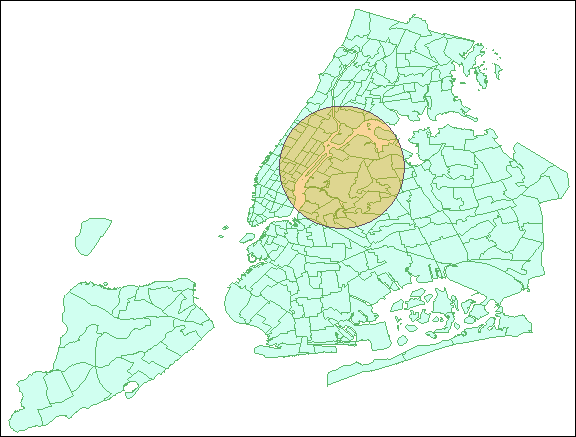
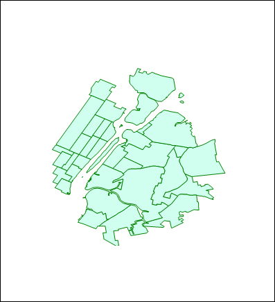
Figure 1: Source dataset (blue region dataset) and query dataset (orange circle) Figure II: The result dataset after the Contain query analysis
Source dataset: Required parameter, specify the dataset to be queried. The query resource page in iServer will list the datasets which meet the analysis condition.
Query dataset: Required parameter, which refers to the dataset where the query object is located. Only the single object query is supported. If there are multiple objects in the query dataset, the object with the smallest SmID will be used as the singel object.
Spatial Query Mode: Different spatial query modes have different requirements for the type of source and query datasets.
IDENTITY, DISJOINT, CONTAIN, INTERSECT, TOUCH, WITHIN: Require the source dataset and the query dataset types are point, line, or region.
CROSS: Requires the source dataset type to be a line; the query dataset type must be a line or a region.
OVERLAP: The source dataset type and query dataset type must be line / line or region/ region.