Using Java API |
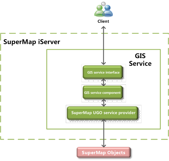
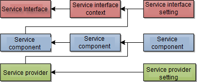
The implementation of SuperMap iServer is divided into three layers: service providers, service components and service interfaces. The service component uses the GIS services provided by service providers, and the GIS functions of the service component can be published in the form of specified service interfaces. This hierarchy structure is good for the encapsulation of the GIS functions to implement aggregation, clustering. Therefore, GIS functions can be published as various types of services conveniently.
One service interface corresponds to one or more service components, and one service component corresponds to one or more service providers. Note that some service interfaces such as WMS service interface can only correspond to one map service component.
A service component can use GIS functions provided by multiple service providers. The service interface can publish GIS functions encapsulated by the service component as Web services.
For more information about the service providers, service components, and service interfaces provided in SuperMap iServer, please refer to Services Providers, Service Components, Service Interfaces respectively. SuperMap iServer Also, users can customzie service providers, service components, and service interfaces, please refer to Domain Spatial Service Extension.
In SuperMap iServer, the complete process for publishing a GIS service is shown as below:
Include the following parts:
For the sample code, please refer to %SuperMap iServer Java_HOME%\samples\code\UseJavaAPI.