Best practices for mapping distributed data vector tiles
|
Feedback
|
1 General
SuperMap GIS version 10.1 supports HBase (this function has been removed since 11.2) and DSF vector data (hereinafter referred to as distributed vector data or distributed data) maps. "tile-free" is achieved by publishing as a vector tiles service through workspace. One of the advantages of vector tiles is the separation of data and style. The vector tiles of distributed vector data also follow MapBox. The style of vector tiles and tiles in MVT specification is described by MapBox standard style. Therefore, the style of some distributed vector data layers will not be supported in vector tiles; In addition, since the distributed vector data layer itself uses a new rendering display mode, the individual style settings of the original layer type (traditional vector data layer) are also invalid for the distributed vector data layer. Therefore, based on the above situation, the layer styles and related settings supported by the distributed data vector tiles are summarized as follows. It is convenient to grasp the correctness and effectiveness of the final vector tiles service display in the distributed data mapping link:
1.1 Data coordinate system
The display of the distributed data vector tiles service supports MapBox GL and OpenLayers rendering display effects. Among them, OpenLayers supports vector tiles rendering display of various projections, while MapBox GL only supports rendering vector tiles that display the EPSG3857 projection.
In practical mapping, if the coordinate system of data is different from the map display coordinate system, dynamic projection can be enabled to achieve correct display. It is suggested that the distributed data map publishing vector tiles service should not use dynamic projection as far as possible to ensure that the data is consistent with the map projection. Otherwise, the generation performance of vector tiles will be reduced.
1.2 Symbolization of layers
When using SuperMap iDesktopX carries out distributed data mapping, the symbolization of its layer and the original layer type (traditional vector data layer) share a set of symbol setting interface and symbolization system. However, because the distributed data layer adopts a new rendering display mode, there are some symbols supported by the original layer type. The distributed data layer is not supported, and when the vector tiles service is displayed, the style of the tile is described by the MapBox standard style, so the style support of the published vector tiles service is not the same as that of the distributed data map. The summary is as follows:
|
Symbol type
|
Symbols supported by legacy layer type
|
Distributed Data Layer
Supported or not
|
vector tiles service
Supported or not
|
|
Point
Symbol
|
system symbol
|
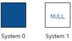
 System0 System0
|
√
|
Not supported
(the dot symbol will be used instead of the display)
|
|
 System1 System1
|
√
|
√
|
|
PNG translucent style
|
√
|
√
|
|
truetype
|
√
|
√
|
|
icon
|
√
|
√
|
|
svg
|
√
|
√
|
|
u The display of u vector tiles does not support symbol scaling with the diagram.".
|
|
Fill
Symbol
|
PNG grid symbol (translucent)
|
√
|
√
|
|
Vector symbol padding
|
√
|
√
|
|
true type symbol padding
|
√
|
Not tested
|
|
System Fill Symbol
|
" |
√
|
√
|
|
"

"
" |
√
|
Not supported
(Replace display with system system0 fill symbols)
|
|
Image Fill
|
√
|
√
|
|
Solid fill
|
√
|
√
|
|
dot fill mode (pin fill)
|
√
|
√
|
|
Gradient Fill
|
Not supported
|
Not supported
|
|
u Support for area symbol contours is exactly the same as for line symbols.
u For custom fill symbols, the vector tiles style only supports fill symbols that contain one fill sublayer, which can be an image fill or a symbol fill type.
|
|
Linetype
Symbol
|
System linetype
|
" |
√
|
Not supported
(solid line will be used instead of display)
|
|

" |
√
|
√
|
|
Railway symbol
|
√
|
√
|
|
Road symbol with lines
|
√
|
√
|
|
Dashed line, dash (system linetype) supported Any dotted line formed by the combination of virtual and real modes
|
√
|
√
|
|
Sub-line end symbol
|
Not supported
|
Not supported
|
|
Subline offset
|
√
|
Not supported
|
|
Other line types 【not dashes (system linetypes)】
|
Not supported
|
Not supported
|
1.3 Production of thematic maps
|
layer type
|
Test Range
|
Distributed Data Layer
Supported or Not
|
vector tiles service
Supported or Not
|
|
dot layer
|
Single value thematic map
|
|
√
|
√
|
|
Segmented thematic map
|
|
Not supported
|
Not supported
|
|
Unified Style Label Thematic Map
|
The label field is a single field
|
√
|
√
|
|
The label field is a simple field expression
(Currently, concatenation of several single fields through the " | | " symbol is supported.)
|
√
|
Not supported
|
|
Line Layer
|
Single value thematic map
|
A single-value field is a single field
(Currently, more than 3000 single-value items are not supported.)
|
√
|
√
|
|
Single-value fields are field expressions
|
Not supported
|
Not supported
|
|
segmented thematic map
|
|
Not supported
|
Not supported
|
|
Unified Style Label Thematic Map
|
The label field is a single field
|
√
|
√
|
|
The label field is a simple field expression
(Currently, concatenation of several single fields through the " | | " symbol is supported.)
|
√
|
Not supported
|
|
Face Layer
|
Single value thematic map
|
A single-value field is a single field
(Currently, more than 3000 single-value items are not supported.)
|
√
|
√
|
|
Single-value fields are field expressions
|
Not supported
|
Not supported
|
|
segmented thematic map
|
|
Not supported
|
Not supported
|
|
Unified Style Label Thematic Map
|
The label field is a single field
|
√
|
√
|
|
The label field is a simple field expression
(Currently, concatenation of several single fields through the " | | " symbol is supported.)
|
√
|
Not supported
|
1.4 Thematic map setting:
|
Thematic Map Type
|
Thematic Map Setting Contents
|
Distributed Data Layer
Supported or not
|
vector tiles service
Supported or not
|
|
point label
|
Wrap settings
|
√
|
Not supported
(defaults to MapBox 's own line-wrapping rules)
|
|
label alignment to point
|
√
|
Not supported
(defaults to MapBox 's own line-wrapping rules)
|
|
label to point spacing
|
√
|
Not supported
(defaults to MapBox 's own line-wrapping rules)
|
|
Text effects: bold, italic, outline
|
√
|
Only bold is supported
|
|
Text effects: strikethrough, underline, shadow, unfixed text size
|
Not supported
|
Not supported
|
|
Label yield buffer
|
√
|
Not supported
(defaults to MapBox 's own line-wrapping rules)
|
|
Text size setting
|
√
|
√
|
|
Font of text, tested common fonts
|
Microsoft Yahei
|
√
|
√
|
|
Wenquanyi Micron Black
|
Not supported
Java Desktop cannot set the font
|
Not supported
Java Desktop cannot set the font
|
|
宋体
|
√
|
√
|
|
bold
|
√
|
√
|
|
callout along line
|
Label shows direction along the line
|
√
|
√
|
|
Line relative angle
|
√
|
Not supported
|
|
tag signature spacing multiple
|
Not supported
|
Not supported
|
|
Cycles along the line (cycle spacing)
|
Not supported
|
Not supported
|
|
alignment (center baseline alignment)
|
Not supported
|
Not supported
|
|
label background
|
Currently only rectangular label backgrounds are supported
|
√
|
√
|
The vector tiles service corresponding to distributed data shows that the following unsupported content exists.
l MapBox style does not support the offset setting of point, line and surface single-value thematic maps.
l For the annotation field used by the label thematic map, only the native field value is supported at present, and the SQL function calculation result cannot be displayed , such as name | | '_' | | type。
l For the same point data set, it is not supported that the single value map and label based on the point data set exist at the same time, otherwise the point symbol of the point thematic map will be lost; However, you can use multiple point ordinary layers to replace the point single-value thematic map, that is, based on the single-value field, different single-value point data are split into independent point data sets, indirectly achieving the effect of displaying different point symbols for different single-value points and displaying point labels.
l For the same point data set, when there are both a point ordinary layer and a label thematic map based on the layer, MapBox does not support setting both the point symbol and the label background; Otherwise, the dot symbol is lost and the label remains, but the label background is offset from the label text.
l The MapBox style only supports two display directions along the line (normal direction along the line and from top to bottom and from left to right). If the map sets other display directions along the line, the vector tiles will use "from top to bottom". Place the label in the left to right direction.
l The text in the map needs to be set to a fixed size, otherwise, the text effect displayed by vector tiles may be different from that of the original map.
l When the bold effect is used for the text, it is necessary to ensure that there is a bold font library of the corresponding font in the computer, so that the bold effect of the text in the generated vector tiles is effective. For example, the text uses the Microsoft Yahei font and is set to be bold. Then you should have the Microsoft Elegant Bold Font Library on your computer.
1.5 Other settings
|
setting content
|
test range
|
Distributed Data Layer
Supported or not
|
vector tiles service
Supported or not
|
|
Color transparency
|
Color transparency setting
|
Not supported
|
Not supported
|
|
Layer property settings
|
Layer transparency
|
Not supported
|
Not supported
|
|
Road intersection optimization
|
Not supported
|
Not supported
|
|
Filter small objects
|
Not supported
|
Not supported
|
|
symbol zooms with diagram
|
Not supported
|
Not supported
|
|
Show Gland Object
|
Not supported
|
Not supported
|
1.6 Summary
The mvt vector tiles service does not yet support all distributed data layer styles. For example, the mvt vector tiles service does not support system symbols well in terms of layer symbolization. However, the expected effect can be achieved indirectly in other ways. For example, if the dotted system linetype is not supported, a new linetype can be created based on the dash (system linetype), and the expected dotted linetype symbol can be obtained by adjusting the virtual and real intervals of the dash; In the aspect of thematic map, the mvt vector tiles service of the thematic map type supported by distributed data is also supported, but in the aspect of setting the thematic map, the mvt vector tiles service basically does not support it. The reason is that mvt vector tiles uses the MapBox specification, so some settings, for example, the wrapping and alignment of the label in the label thematic map are processed by the MapBox rendering engine; Therefore, in general, the mvt vector tiles service can basically support most of the distributed data layer styles.